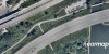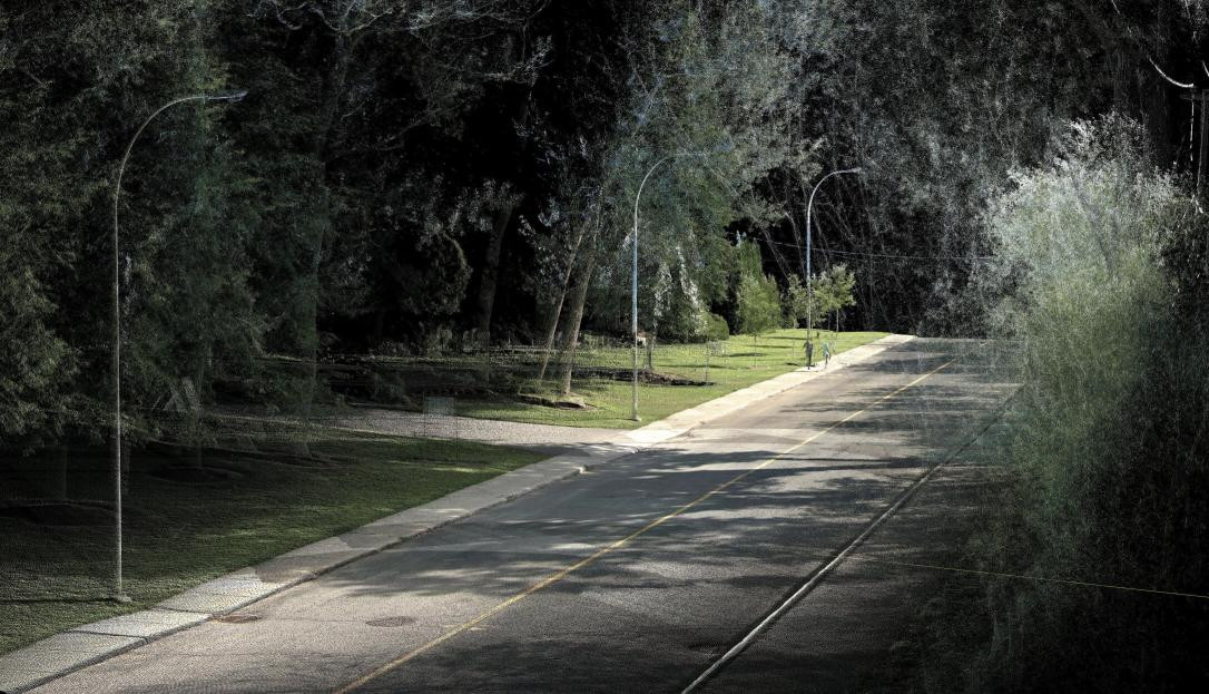
QUEBEC CITY- 2022-08-24| Geoselec is pleased to inform you that its marketplace is now providing data produced by Jakarto, an important player in mobile mapping. This Montreal company’s unique business model involves the capture, processing and sale of 3D HD data. Jakarto creates an HD digital twin of landscapes and structures, with specialized vehicles equipped with two (2) LiDARs that generate two million points XYZ per second, and 5 cameras that record the images of the areas covered.
This agreement enables professionals from various sectors (planning, engineering, surveying, etc.), who are used to purchasing historical or current digital aerial images on Geoselec’s platform, to access the company’s ever-increasing geographical content through its centralized marketplace.
Users have access to the following Jakarto products, listed according to their area of interest:
- 2D orthophotos, 2D raster background, according to the reflectivity captured by LiDAR;
- 2.5D (DTM), 2D background raster that illustrates the terrain, digital model type terrain 2D, issued from LiDAR data;
- 3D digital twins, HD LiDAR point cloud with spherical images;
- 360 scene, HD LiDAR point cloud with spherical images.
Geoselec would like to thank Jakarto for agreeing to join a unique geospatial information distribution platform: Geoselec’s “marketplace”.
About Geoselec
Geoselec is the Canadian leader in the digitization and distribution of historical and current aerial photography. Through its e-commerce and online distribution platform, Geoselec provides imaging content of varied sources and partners (Nearmap, Gouvernement du Québec, Geoselec, etc.). Its mission is to facilitate access to geospatial data and to contribute to the digital transformation of analog data.
About Jakarto
Jakarto, which was founded in Montreal in 2017, offers innovative solutions to geospatial and AEC professionals (architecture, engineering, construction), and collaborates with municipalities, public services and owners/managers of websites and transportation networks. Jakarto captures 3D high definition geospatial data (3D HD mapping) with its mobile units, mapping Quebec and Eastern Canada’s cities and infrastructures. It distributes 3D digital twins and 2D/2.5D data layers through its data catalog, combining LiDAR and colour imagery.
Source: geoselec.com
Information:
Geneviève Grenier ǀ CEO ǀ Genevieve.grenier@geoselec.com
Félix Laroche ǀ CEO ǀ felix@jakarto.com