Québec, November 17th, 2025
K2 Geospatial and Geoselec announce a strategic integration enabling JMAP users — the geospatial platform widely used by cities and regional county municipalities (RCMs) across Québec — to directly access Geoselec’s catalog of historical aerial photographs.
Through this new extension developed by K2 Geospatial using the Geoselec API, organizations now have a simple and effective tool to identify data on land-use evolution and support operational decision-making.
A new layer of territorial intelligence for cities and RCMs
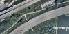
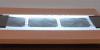
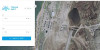
The integration allows users to quickly browse the index of available historical aerial archives for a given area, view metadata, and preview images for later ordering or orthophoto production. This solution directly supports practical needs in urban planning, engineering, environmental management, and public asset management.
“Thanks to this integration, JMAP users can now access the territory’s historical imagery in just a few clicks — right where they already perform their geospatial analyses.”
— Geneviève Grenier, President and CEO, Geoselec
This initiative reflects the natural evolution of geospatial systems in Québec, where data discoverability has become a key issue for both planning and municipal management.
A pragmatic, field-oriented collaboration
Developed collaboratively between the two technical teams, the extension leverages Geoselec’s API and allows for continuous catalog updates. The integration adds to JMAP’s ecosystem of interoperable tools and expands its potential use cases for public organizations.
“This collaboration simplifies access to a valuable source of information for territorial planning and the analysis of built-environment evolution. Integrating Geoselec into JMAP aligns with our commitment to delivering practical, everyday tools to our clients.”
— Jacques Charron, CEO, K2 Geospatial
Immediate Benefits for Public Organizations
-
Direct access to the catalog of historical aerial photographs
-
Geographic area search directly from the map
-
Metadata visualization (flight year, series, scale, index)
-
Image preview before ordering
-
Work within a single GIS environment — no need to switch between platforms
This integration demonstrates the shared commitment of K2 Geospatial and Geoselec to making geospatial data more accessible and actionable for territorial decision-makers.
About Geoselec
Geoselec specializes in the preservation, digitization, and enhancement of historical aerial archives in Québec. Through its online consultation platform and specialized services, the company provides access to a unique geographic heritage that supports territorial planning, environmental research, and the use of historical data.
About K2 Geospatial
Since 1995, K2 Geospatial has been designing solutions that enable users to access and visualize geospatial data to support informed decision-making. Its JMAP platform is used by hundreds of organizations to connect, integrate, and efficiently leverage their spatial data.
Media Contacts
Geoselec
info@geoselec.com
K2 Geospatial
ejacquin@k2geospatial.com
—30—