Partner and Content provider: Geosapiens
Geoselec marketplace distributes Geosapiens’ flood risk data throughout Canada.

Founded in 2017, Geosapiens is a Quebec firm that specializes in modeling and developing new operational flood risk management tools. Geosapiens’ mission is to contribute to the safety and integrity of the population in the face of natural and climatic risks, through technological solutions based on geospatial data. Geosapiens seeks to provide the population as well as public and private organizations with reliable and intuitive decision support tools, enabling them to better understand, prevent and manage natural risks.
Thanks to its mapping and modeling solution, Geosapiens can provide specialized and accurate geospatial data. Learn more at www.geosapiens.ca/?lang=en
Soon available on Geoselec’s marketplace:
- Flood-prone area maps for 5 flooding scenarios
- Flood-prone area maps for 10 flooding scenarios
Product's examples

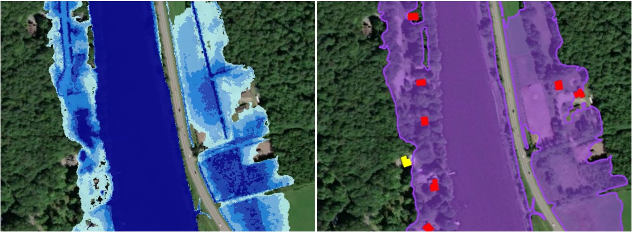
Map 1. Extent and depth of water for a specific floodplain
Map 2. Extent of a floodplain and risk assessment for damaged or isolated buildings.
Product advantages
- More flooding scenarios than from any other data available
- Maps offered in raster format, rendering more details
- High-quality data (frequent updates, validation and accuracy)
Products, prices and processing times
|
Products |
Options |
Prices |
Processing times |
|
Flood-prone area maps for 5 flooding scenarios |
PDF (.pdf) Raster (.tif) Shapefile (.shp) |
$100* $150* $125* |
5 working days |
|
Flood-prone area maps for 10 flooding scenarios |
PDF (.pdf) Raster (.tif) Shapefile (.shp) |
$175* $275* $225* |
5 working days |
* per tile of 250m x 250m


